
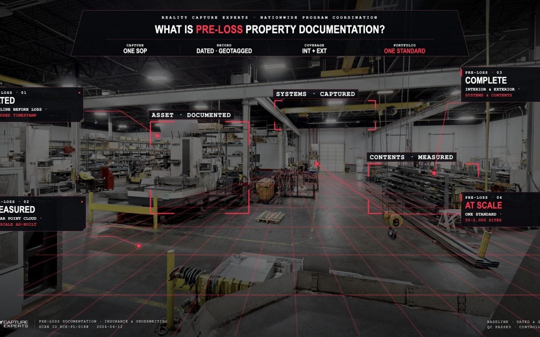
Pre-loss property documentation is a dated, detailed record of a building’s condition captured before any loss occurs. It pairs measured visual data — often a Matterport 3D scan with embedded LiDAR measurements — with replacement-cost and asset detail, so an owner can prove exactly what existed, where, and in what shape on a specific date. Underwriters want it because documented risk is easier to price, and dated evidence settles claims faster and with fewer disputes.
For a single building, one internal teamate with a scanner can handle it. For 50, 200, or 2,000 locations, the hard part is not the capture — it is coordinating consistent capture across every site, on a schedule, to one standard. That coordination is what Reality Capture Experts delivers as a managed service nationwide.
What does pre-loss documentation actually include?
At its core, pre-loss documentation answers three questions about a property on a known date: what is here, how much of it is there, and what condition is it in. A complete record combines a navigable 3D capture of the interior and exterior, accurate measurements pulled from the point cloud, and supporting detail on building systems, finishes, and high-value contents.
The 2026 commercial property market has made this concrete. Underwriters now ask for valuation reports, roof details, maintenance logs, mitigation improvements, and photos — anything that reduces uncertainty about a risk. A Matterport capture rolls most of that visual evidence into one dated, measurable file, and an as-built record built from the scan supports the rest.
Why do underwriters and adjusters care about a dated record?
Because uncertainty costs money. Properties with current, accurate replacement-cost valuations have generally seen modest, inflation-driven limit increases in the 3–6% range, while properties with thin documentation absorb the underwriter’s worst-case assumptions. A dated baseline removes guesswork on both sides of the table.
On the claims side, the value is timing and defensibility. A 3D scan is timestamped and geotagged, which makes it hard to dispute when a question comes up months later about what a space looked like before a loss. That is why 3D documentation has moved into forensic and claims workflows — adjusters can “walk” a loss site remotely and compare it against the pre-loss baseline. We cover the evidentiary side in depth in our guide to what makes a 3D property scan defensible in a claim.
How is pre-loss documentation different from the photos we already take?
Photos show one angle. A 3D capture shows the whole space, to scale, in a way you can measure and revisit. The practical difference shows up when a claim is contested: a folder of phone photos rarely proves dimensions, adjacencies, or the condition of areas no one thought to photograph. A scan captures the room whether or not anyone anticipated the question.
This matters most for replacement cost. You cannot defend a coverage limit you cannot substantiate. We break down the measurement and valuation workflow in Matterport vs. photos for claims documentation, and the valuation side specifically in how to document replacement cost value for commercial property insurance.
What does “documented at scale” mean for a multi-site portfolio?
For a risk manager or facilities leader responsible for dozens or hundreds of locations, the goal is one standard applied everywhere, not a different result at every site. That means the same capture coverage, the same file naming, the same measurement accuracy, and the same delivery format across the whole portfolio — so the data is comparable building to building and ready when underwriting or a claim needs it.
This is the line between a do-it-yourself model and a managed one. Self-serve capture leaves the owner training operators, buying hardware, and chasing consistency site by site. RCE runs it as a coordinated program with a single point of contact, scheduled capture, and quality control applied to every deliverable. The mechanics of running that across geographies are covered in how to run pre-loss surveys across many locations.
How does RCE handle a pre-loss documentation program?
RCE scopes the program first: which sites, what coverage at each, what accuracy and deliverables underwriting or risk needs, and on what timeline. From there we coordinate scheduling with each location’s point of contact, deploy capture nationwide, and run every scan through QC against the agreed standard before it is delivered.
The owner gets one relationship and one standard, not a stack of vendors. The point cloud, the navigable Matterport space, and the as-built measurements land in a consistent format, dated, and ready for the underwriter, the broker, or — if it ever comes to it — the adjuster.
Frequently Asked Questions
Is a Matterport scan accepted as evidence in an insurance claim?
3D scans are timestamped and geotagged, which makes them difficult to alter and widely used in claims and forensic documentation. Acceptance depends on jurisdiction and the specifics of the claim, so RCE focuses on capturing a clean, dated, well-organized record that supports the claim rather than making legal guarantees.
How often should pre-loss documentation be refreshed?
A practical rhythm is to re-baseline after any major renovation, tenant change, or capital improvement, and on a recurring cycle that matches your valuation review — often every two to three years — so the record stays current for underwriting.
Do we need to document every site, or just high-value ones?
That is a risk decision. Many organizations start with their highest-value or highest-exposure locations, then extend the same standard across the portfolio. RCE can scope either approach and keep the standard identical as you expand.
Who coordinates access at each location?
RCE coordinates scheduling and access with each site’s point of contact as part of the managed service, so your team is not juggling operators and calendars across the country.
What Happens Next
A pre-loss documentation program starts with scope: a list of sites, the coverage each one needs, and the date you want the baseline set by. From there RCE coordinates the capture, applies one QC standard nationwide, and delivers a dated record you can hand to underwriting or a claim. The work product is consistent because the program is managed — not assembled site by site.